Flying in the mountain always requires a lot of patience to wait for good weather. This spring was particularly windy and we could not fly for almost two weeks, because conditions were never quite right. But finally we completed a survey of Glacier Bay (I wasn't there for that), the Sargent and Harding Icefield, and the Eastern Alaska Range. Below are just a few impressions:
 |
| The calving front of Chenega Glacier in Prince William Sound with a small calving event caught in the act |
 |
| Excelsior Glacier is a rapidly retreating outlet of the Sargent Icefield, calving big icebergs into a proglacial lake |
 |
| Beautiful internal waves |
 |
| Root and Kennicott Glacier with Mt. Blackburn |
 |
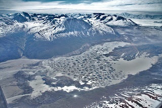
| The Tana Glacier is also retreating rapidly with a proglacial lake that is getting bigger each year |
No comments:
Post a Comment