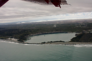
I've written about Yakutat Glacier before, since we had a NSF funded project there a few years ago. This is a big glacier and one of the most rapidly changing in Alaska. In fact, in a recent paper we showed that the glacier is very likely to disappear within this century, even without further warming. In the past few years the glacier has lost well over 10 km2 of area, and this rapid retreat is continuing. Now, it is the east branch that is rapidly falling apart.
Thursday, May 28, 2015
Monday, May 25, 2015
Mapping the Malaspina Glacier
The Malaspina Glacier is a large so-called piedmont glacier. It is fed by the vast icefields of the Coastal Mountains and extends out to the coastal plain. Much of its ice is at very low elevation (near sea level). A large part of it has become stagnant and has been thinning for decades now. We mapped the glacier with radar to see how much of the base is located below sea level. That makes it particularly vulnerable to rapid change.
 |
| Much of the ice has become so stagnant that trees are growing on top of the glacier! |
 |
| The vast expense of the Malaspina Glacier |
 |
| Collapsing ice is the only indication that this tree-covered landscape is actually a glacier |
 |
| Looking out from near St.Elias towards the Pacific Ocean |
 |
| Ocean water is reaching the glacier front in this lagoon. If the glacier started to calve ice into lakes like this, the demise of the ice could be accelerated greatly. |
 |
| Moraine patterns |
 |
| An example of a radar profile. Radar waves can penetrate several 100 m's into glacier ice and measure its thickness. |
Impressions from Operation IceBridge Alaska
Each year we fly over many of Alaska's glaciers with lasers and radar to measure how much the ice surface is changing (laser) and how thick the ice is (radar). Here are some impressions from the May campaign that was just concluded.
The first few pictures are from Icy Bay, one of the most spectacular places I've ever seen.
Hubbard Glacier is one of the very few advancing glaciers in Alaska and indeed the whole world. If the advance continues, it threatens to close of an entire fjord and turn it into a lake. We expect that to happen (at least temporarily) in the next few years. But not this year, apparently. The gap at Gilbert Point is much wider than it usually is this time of the year. It's possible that this is attributable to much warmer than usual ocean water in the Gulf of Alaska.
The first few pictures are from Icy Bay, one of the most spectacular places I've ever seen.
 |
| The mighty Mt. St. Elias (5,489 m) |
 |
| The top of Mt. Wrangell, a massive ice-covered shield volcano |
Hubbard Glacier is one of the very few advancing glaciers in Alaska and indeed the whole world. If the advance continues, it threatens to close of an entire fjord and turn it into a lake. We expect that to happen (at least temporarily) in the next few years. But not this year, apparently. The gap at Gilbert Point is much wider than it usually is this time of the year. It's possible that this is attributable to much warmer than usual ocean water in the Gulf of Alaska.
 |
| The gap at Gilbert Point |
 |
| Dirt-covered glacier ice advancing onto a glacial outwash plain |
 |
| Snow runnels, higher up on the glacier |
 |
| Beautiful blue supraglacial lake. Melt is earlier than usual this year with record May temperatures. |
 |
| The Bagley Icevalley |
 |
| This lake has filled, clearing the ice, and then drained, leaving clean ice exposed |
 |
| The Kennicott Glacier by McCarthy with the beautiful Stairway Icefall, which must be one of the highest ice falls in the world. |
 |
| A rockfall on the West Fork Glacier in the Alaska Range. It happened during the 2002 Denali Fault Earthquake. |
 |
| Mt. Blackburn and the Kennicott Glacier |
Sunday, May 3, 2015
Black Rapids Airforce
Since the early 1970s the changes of Black Rapids Glacier have been measured annually. Initially this was done by the USGS, then UAF. Sometimes, we have funding from NSF to continue these measurements. But often we don't and in those years we've relied on volunteer pilots to get us there for a day to do the necessary measurements. This year I got my own wheel-skis, and for the first time I was part of the volunteer flying team, the Black Rapids Air Force! We couldn't have chosen a more beautiful day!
Subscribe to:
Posts (Atom)


