Monday, October 23, 2017

Operation IceBridge Fall campaign

I'm being increasingly lazy about keeping this field blog up to date, but since it is complete over the past few years, I am going to update it. Better late than never!

In the second half of August we flew the Operation IceBridge Alaska mission. This is a NASA sponsored mission with the primary goal of measuring elevation change of many glaciers all over Alaska. I am doing radar surveys to try to measure the location of the bottom of the glacier.

These missions always result in lots of waiting for suitable weather, interrupted by long days when conditions are good. But this August we had a particular sustained stretch of very windy conditions, and we ended up not being able to fly our primary targets. We still got some work done. Below are some impressions.

Unfortunately I had my ISO set to something ridiculously high, which is why this picture appears so grainy. But it is amazing nonetheless: The surging Walsh Glacier destabilized a slope and this led to a clear fracture through a rock glacier, exposing an entire cross section. It nicely shows that much of the inside of a rock glacier actually consists of ice. I think it's even more than what appears here, because debris would have quickly covered some of the ice.

Beautiful fall colors


Kennicott Glacier has been retreating and creating this proglacial lake that rapidly increases in size

The surging Klutlan Glacier


Sunday, July 30, 2017

Back in Greenland

I had an opportunity to join a team of scientists from the UK's Scott Polar Institute at Store Glacier in western Greenland. This is one of the big outlet glaciers of Greenland,  but contrary to many other glaciers in the area, the front has been relatively stable over the past decades. I went there to set up a terrestrial radar interferometer, which is an amazing instrument that can measure ice velocity at very high resolution (every 3 minutes in this case).

Travel to the field site was interesting because Air Greenland had many weather delays, so I arrived in the town of Uummannaq with a 3-day delay. To get to Uummannaq is complicated: From Kangerlussuaq you travel via Ilulissat and then Qaarsut on small airplanes (Dash 8) and then with a helicopter for the last bit, because there is not really sufficient space for an air strip at Uummannaq. I spent two unplanned nights in Ilulissat, which was nice, since I had spent a lot of time there, but not in the past 5 years. It is amazing to see how many tourists there are now. 

I ended up spending only four days in the field to set up the instrument and train the team how to use it. Below are some impressions from the trip.

Ilullissat: The city of ice bergs

The ice fjord outside Ilulissat

A snow fall in July, which is very unusual, contributed to several days of delay

Icebergs in the midnight sun

Uummannaq Island with the town (on the left flatter side)
The Uummannaq harbor with the big rock behind it
An interesting iceberg near the Uummannaq harbor

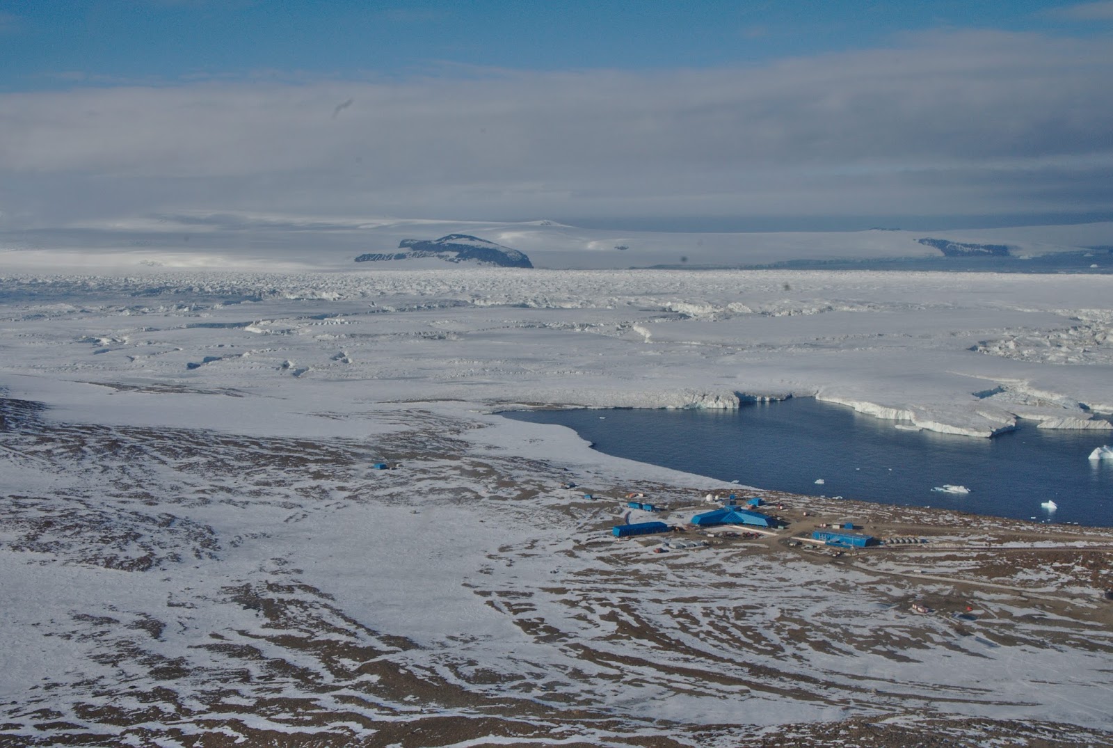
The terrestrial radar interferometer set up by Store Glacier


The Ilulissat icefjord on the way home
Nice evening light near Kangerlussuaq


Wednesday, June 28, 2017

Operation IceBridge Spring campaign

For the past several years I joined the Operation IceBridge Alaska campaign. The primary goal for this NASA funded work is to measure glacier change with an airborne lidar. We also try to measure ice thickness with a radar, which is a tricky proposition, because the radar signals bounce of all the mountains and obscure the returns from the glacier bed.
Flying in the mountain always requires a lot of patience to wait for good weather. This spring was particularly windy and we could not fly for almost two weeks, because conditions were never quite right. But finally we completed a survey of Glacier Bay (I wasn't there for that), the Sargent and Harding Icefield, and the Eastern Alaska Range. Below are just a few impressions:
The calving front of Chenega Glacier in Prince William Sound with a small calving event caught in the act

Excelsior Glacier is a rapidly retreating outlet of the Sargent Icefield, calving big icebergs into a proglacial lake

Beautiful internal waves

Root and Kennicott Glacier with Mt. Blackburn

The Tana Glacier is also retreating rapidly with a proglacial lake that is getting bigger each year

Thursday, June 8, 2017

How deep is the Bagley Icevalley?

We have been trying to measure the depth of the Bagley Ice Valley for years, using airborne radar. But it has been an enigma; we suspected because of its depth. Temperate ice (ice at its freezing point) contains water and that makes it really difficult for radar waves to penetrate. We had a chance to do a survey on the ground with a very low frequency system and it looks like this was successful. We are still working on the data, but it looks like we've found ice that is more than 1500 m thick.

Deployment by Ultima Thule's Single Otter

The front half of the radar setup with antenna and a sled containing the receiver

How far is it to bedrock? Photo: Jack Holt

Pulling the radar across the glacier. Michael on the snowmachine and I'm being pulled on skis. Photo: J. Holt

Wednesday, June 7, 2017

Black Rapids Glacier

Every year in spring we make a trip to Black Rapids to do some mass balance measurements. Once again we found a beautiful day for it, and this time my daughter Sonja got to join me as well.

Surprisingly, Black Rapids Glacier had quite a low snow year; it was one of the thinnest snow covers we've measured in several decades. It's surprising, because Fairbanks had quite a nice year. In general, Black Rapids Glacier continues to thin rapidly.


Tuesday, May 16, 2017

Glacier caves

I've been slacking with this blog. Here is a picture from a visit to Juneau during spring break. We got an opportunity to visit the glacier caves at Mendenhall Glacier. Amazing!


Wednesday, February 15, 2017

Drilling through the Nansen Ice Shelf

We just returned from the Nansen Ice Shelf, where we drilled two holes through 400 m of ice. We installed ocean instruments into the ocean cavity below the ice. A relatively new technique allows us to measure a continuous profile of ice and water temperatures with a fibre optics cable. All instruments are now read by an AMIGOS II station and data relayed to NSIDC in Boulder CO by Iridium modem. The station was built by Ronald Ross of Polar 66 and Ted Scambos of the University of Colorado, and Dale Pomraning and I were responsible for the hot water drilling.

A view down the Nansen Ice Shelf. The two islands in the shelf are Inexpressible Island in the distance and Vegetation Island. Inexpressible Island was the location where Scott's Northern Party spent a miserable and very windy winter dug into a snow cave. The reason for the name is that the actual names given by the surviving party where not fit to print.


Vegetation Island, named for the lichen that apparently grows there
Our camp cook tent

Master driller Dale

The hot water drill system with drill hose in the foreground, water basins, pump and heaters
Jin Suk, our Korean helper, finds hot water drilling very exciting!

The Eisenhower Range. Note the drifting snow plumes over the mountains.

Camp with impressive snow drifts in the background.
 This area is famous for extreme wind. We were lucky at our camp, but were surrounded by wind with some incredible amounts of snow drifts.


The valley in the center is filled by snow drifts that must be well over 100 m high.


One day a penguin decided to visit our camp and he stuck around for about 24 hours. The penguin was molding; during that time they cannot go in the water. Why they wander so far onto the iceshelf is anybody's guess.


During one night of drilling we were treated to a full moon rising in the midnight sun. 


The completed AMIGOS II station.

While we were drilling, other science activities occurred in this area. This is a helicopter with three booms that house radar antennas doing ice thickness surveys.

The Jang Bogo station on our return trip with the Campbell Ice Tongue and Mt. Melbourne in the background.