Monday, June 14, 2021

Malaspina Glacier: Take 1

 Malaspina Glacier is an amazing place. It is one of the last piedmont (meaning 'foot of the mountain') glaciers in Alaska. That puts a large amount of ice at really low elevation where it is prone to melt rapidly. Previous measurements have shown that much of the lower glacier's bottom is well below sea level, meaning that a retreat would lead to the formation of a large lake or series of lakes, or potentially an ocean bay. In a new proposal funded by the National Science Foundation we are going to explore a number of possible retreat scenarios for the glacier. In the first week of June we did our first trip to establish field instrumentation.


All operations for Malaspina start in Yakutat, a cool coastal town of Alaska with some amazing temperate rain forest.

An interesting part of Yakutat is Cannon Beach, which was fortified against a possible Japanese invasion

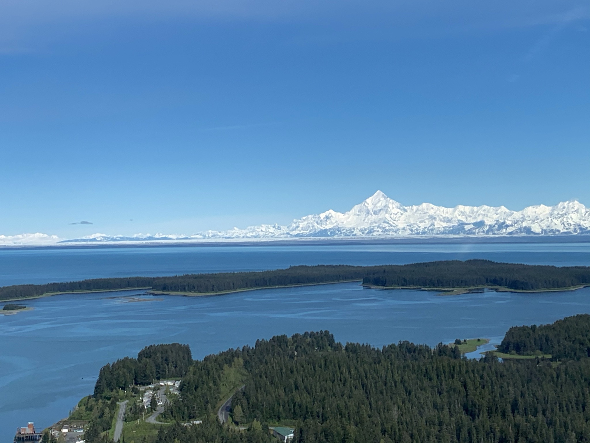
The majestic Mt. St.Elias as seen from Yakutat. The sliver of white in front is the mighty Malaspina.

A combined station to measure motion (GPS), melt (via a draw wire) and some basic weather.

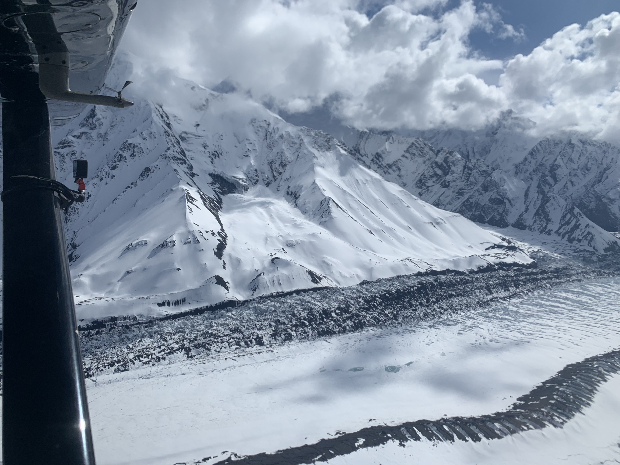
And here is St.Elias again, this time from the glacier


Victor is drilling a mass balance stake.

Parts of Malaspina are currently surging, moving at several meters a day. This adds a bit of a challenge!

We put up a weather station near the coast. We'll see what the bears think about that...

And here is the advancing lobe of the surging glacier

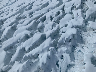
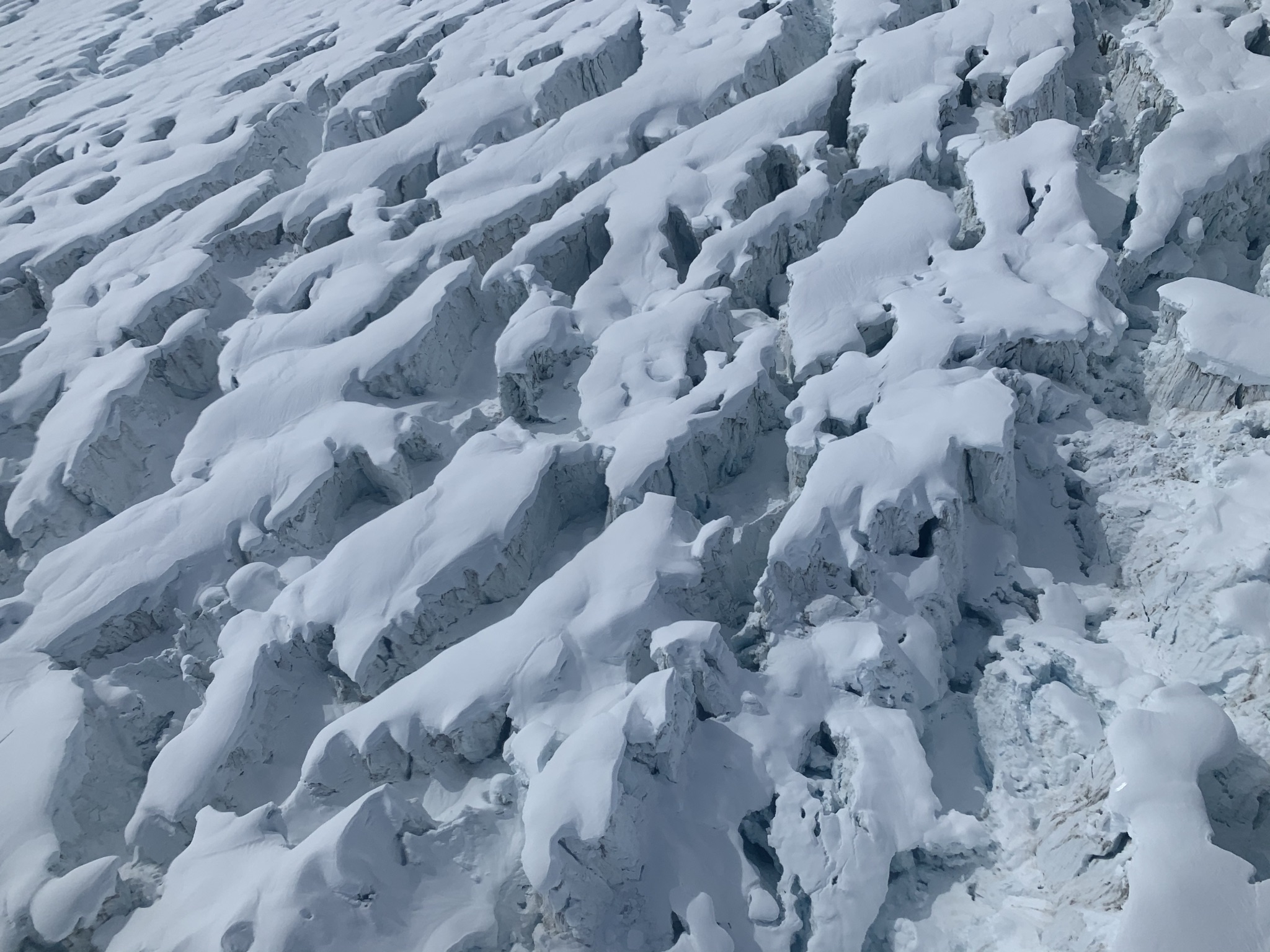
Some close-ups of the surge front

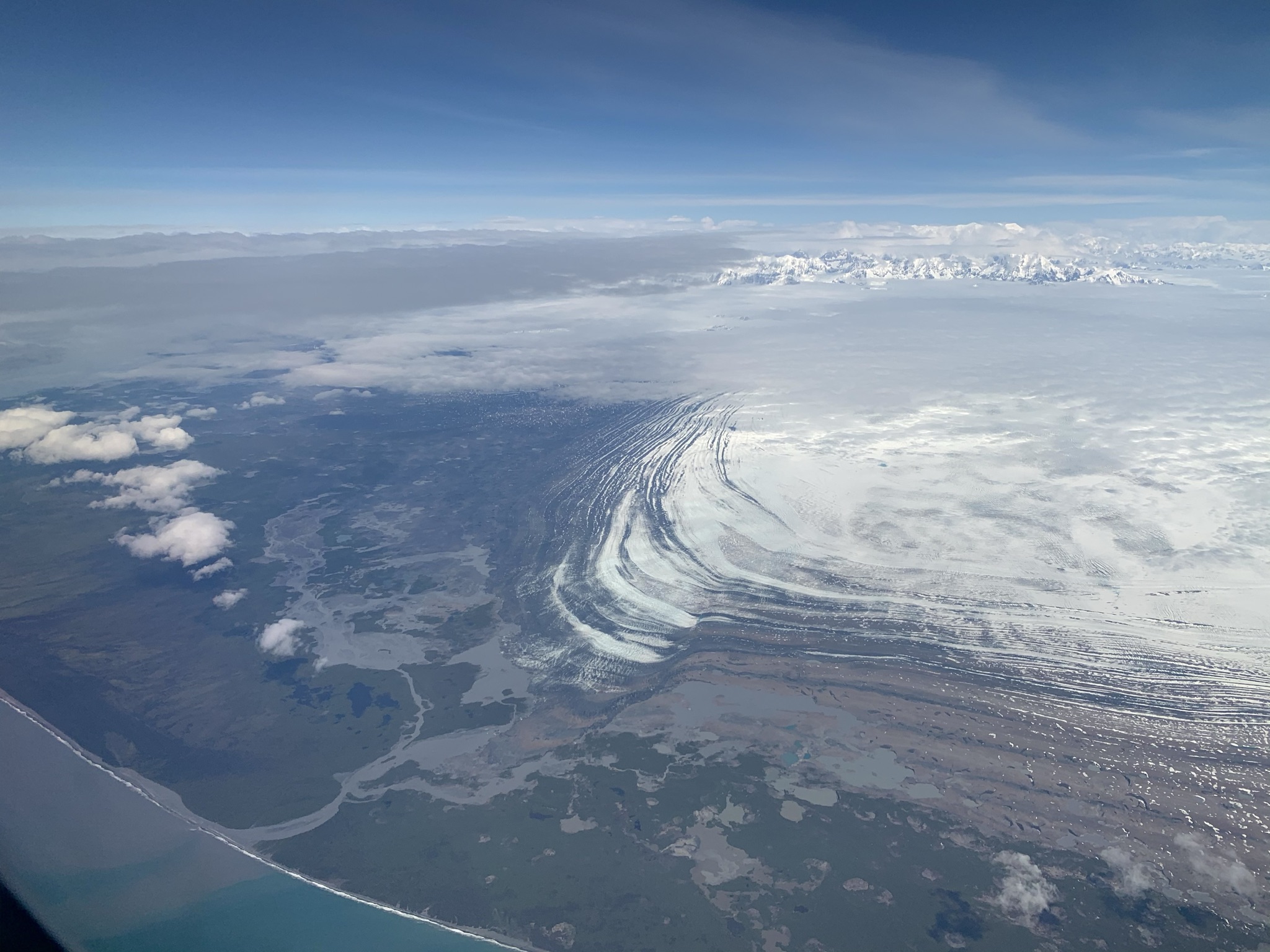
And finally, a few shots from the way back from Yakutat from an Alaska Airlines jet in beautiful weather.


This shows the possible ways that Malaspina Glacier could be connected to ocean water.


Monday, June 7, 2021

Muldrow surge

 The Muldrow Glacier surge has been getting a lot of attention with articles in the NY Times and more recently one in the Washington Post. And rightly so: after more than 60 years of a quiet life in the mountains the glacier has sprung into action. There were some tentative signs a few years ago, and I had a previous blog post from flying over it. But then this winter it went really crazy with ice moving faster than 20 m/d, which isn't exactly what we think of when we talk of a glacial pace. 

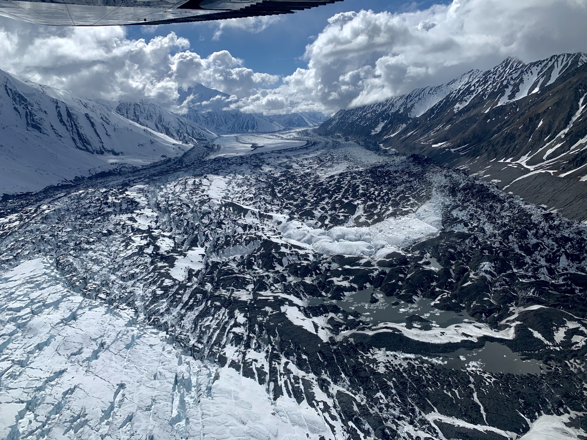
Two of our graduate students recently spent a few weeks at the glacier doing detailed measurements with a ground-based terrestrial radar. I finally got a chance to look at it myself; here are some photos. It is a pretty spectacular sight.


Very pronounced shear margins with chaotic crevassing

This was a smooth glacier surface just a few months ago


Some (but not all) tributaries are very engaged in the surge

A view into the upper glacier (Traleika junction). Note the ice that is stranded many tens of meters above the glacier surface. This is the surge reservoir area, the part of the glacier that has been building up over decades and is now being depleted in just a few months.


Near the glacier terminus: Ice is building up to impressive heights

The surge front advancing into the glacier forelands


If you look carefully you can spot David and Emily's camp (yellow Arctic Oven) and the terrestrial radar interferometer


Saturday, May 29, 2021

Operation IceBridge Alaska: The last hurrah

I had the great fortune to be involved in Operation IceBridge Alaska for almost a decade. But all good things must end. We had a last campaign this May. This was primarily a radar mission. We had fantastic results, seeing glacier bed in places we were never before successful. As usual, some pictures:

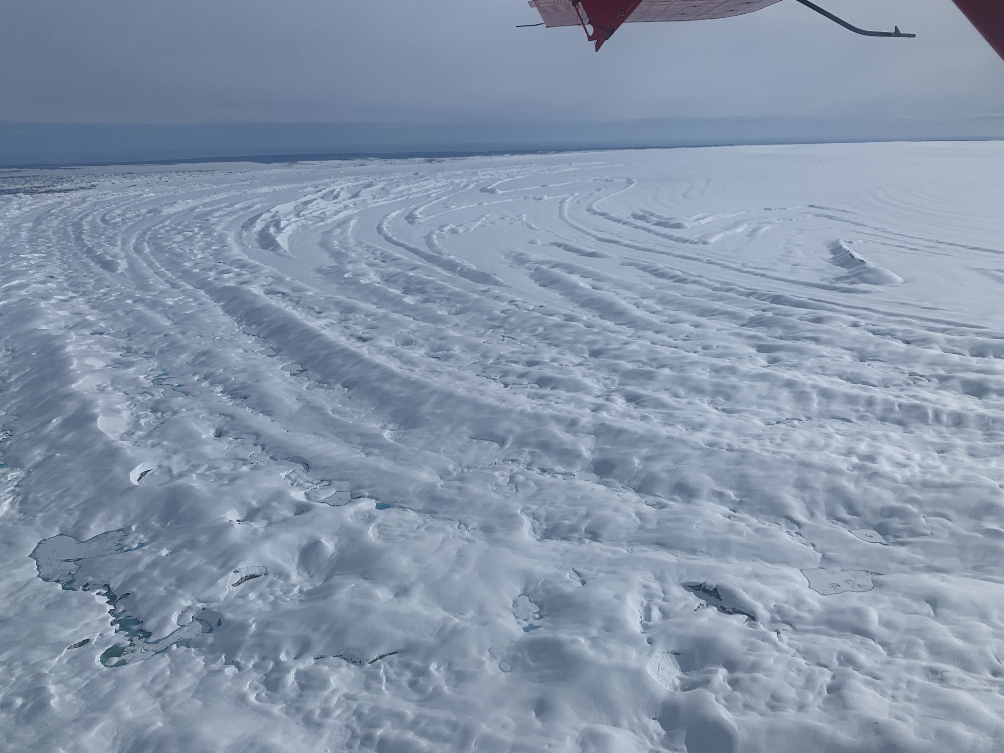
Malaspina Glacier: we flew a very dense grid over the Malaspina Glacier. Much of this large glacier is based below sea level and it is likely that this glacier will not survive in the current climate. We have just started a project to look at this in more detail.

The snow covered moraine patterns on the Malaspina Lobe 

The Gulf of Alaska coast in front of Malaspina

Sitkagi Lagoon is one of the places where warm ocean water is gaining access to glacier ice

Fresh crevassing from an ongoing surge on the Malaspina

Near the surge front: the ice is advancing into proglacial lakes

A wall of advancing ice
A view from the surge front up the lobe of the glacier
This ice would have been easy to walk over, just a few months ago. Now it is totally broken up.

Ice spilling out of the Seward Glacier into the lobe of Malaspina.


The mighty St. Elias


Mt. Bona: The saddle between Mt. Bona and Mt. Churchill was used as a drill site many years ago to retrieve an ice core. We acquired good ice penetrating and snow accumulation radar data over the area.

The neighboring Twaharpies sticking up through the clouds

University Peak
The saddle between Mt.Bona and Mt.Churchill


The Bagley Ice Valley: This is the largest expanse of ice in Alaska. We managed to image its base at up to 1500 m thick. I believe this is the deepest warm ice ever seen by an airborne radar.

The Bagley Ice Valley with the massive Mt. Logan and Mt. St.Elias in the far distance.

This is a view of the Hubsew ridge on Mt. Logan. This was first climbed by my PdD advisor Will Harrison, who recently passed away. He wrote a really entertaining and amazing story about the climb in the American Alpine Journal.

Clouds boiling over into the Bagley Valley; time to get out of there....

Mt. Wrangell is a large shield volcano with a deep caldera and it is the origin of one of the biggest land terminating glaciers in Alaska: Nabesna Glacier.


Mt. Blackburn on the way to Mt. Wrangell. The ridge that extends towards the viewer was first climbed (I think) by my friends Keith Echelmeyer, Franz Mueter and myself.

That's our route (approximately). The good old days ...


The Mt. Wrangell caldera with steam


And here are a few random pictures:

Granite Creek valley on the way back from a mission. I like this beautiful old moraine.


Icebergs breaking off from the Nizina Glacier


Vitus Lake in front of Bering Glacier
The team from University of Arizona, UAF, and University of Kansas (who did snow accumulation measurements)