Wednesday, June 21, 2023

Lituya Bay: site of the biggest ever recorded tsunami wave

I had a chance to join a field team in Lituya Bay, one of the most dynamic landscapes I have ever seen. 

Lituya Bay is well-known for the highest ever recorded tsunami. During a large earthquake in 1958, a piece of mountain slid into the ocean and created a wave that reached to about 500 m (1,600 ft) above sea level. The scars are still visible (see picture below). There were several fishing boats in the bay at the time; amazingly some of them survived!

At that time the bay was distinctly T-shaped with open water in the area now occupied by the termini of both Lituya and Crillon Glaciers. The glacier advance is made possible by very large amounts of sediment that were dumped into the bay and that protect the glaciers from tidewater.

The Lituya and Crillon Glaciers are right on top of the Fairweather Fault, one of the most active strike/slip faults in North America. Lituya Glacier also dams Desolation Lake, which drains every year underneath the glacier into the bay in a very impressive flood. 


I got dropped off by float plane from Juneau to join the team that had already been out for about a week or ten days.

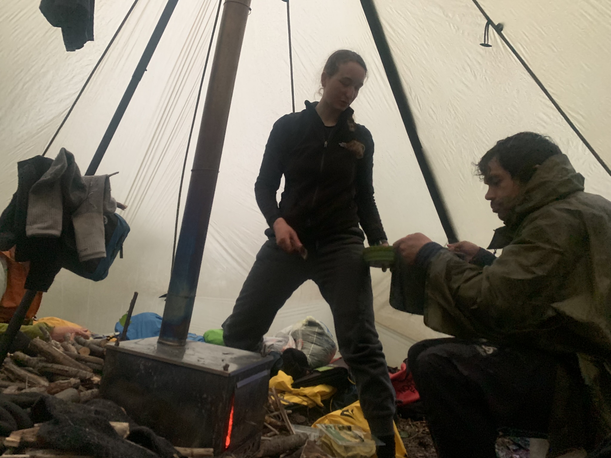
The team had already worked through some epic rain storms, and it didn't really get dry until the day we left. Saving grace was a nice common tent with a small wood stove to dry out.

My job on the glacier was to do Radio Echo Sounding to determine glacier depth. It's a challenge to operate electronics when it's so wet, an umbrella really helps!

In the mean time the 'Kontiki' (2 joined packrafts) conducted multibeam survey of the bay to see how much sediment has filled into the bay. This is probably the most innovative multibeam I have ever seen....


The terminus of the Lituya Glacier. The glacier has been


View from the Lituya towards the Crillon Glacier

The outwash delta of the Lituya Glacier. This was all ocean a few decades ago. At the side the scars from the outburst floods are visible.

Our last night in Lituya Bay: the weather turned nice!


Desolation Lake, looking straight down the Fairweather Fault


Looking out towards the Pacific with Cenotaph Island. The hill in the foreground is where the 1958 tsunami wave swept up the mountainside. All the light green vegetation shows areas that were stripped clean of trees. It is hard to imagine that.

The 'green moraine' on Crillon Glacier

Crillon Lake

This was on the way out: a series of beautiful lakes occupying former glacier beds that hadn't quite reached the sea shore.


Friday, June 9, 2023

Some of Earth's biggest mountains

 As part of our project on Sít' Tlein (Malaspina Glacier) we decided to do field work on the upper glacier (also known as the Seward Glacier). The goal was to deploy several radars: one to measure the ice thickness and one to measure the annual snow fall. Both of these things are very poorly constrained in the area. Since this part of the glacier is in Canada, we drove to Kluane Lake and deployed from there.

I was a bit nervous about this work, because this is an area of the world that can be hit with big storms that make it inaccessible by air for long periods of time. But we got lucky and hit an unbelievable stretch of amazing weather.

The area is incredibly spectacular. We were camped between the giant mountains of Mt. Logan, Mt. St. Elias (Yasʼéitʼaa Shaa, "the mountain behind Icy Bay), Mt. Vancouver, Mt. Augusta, Mt. Cook, ... Huge mountains on every side of us. Mt. St. Elias rises straight out of the ocean to over 5400 m (18'000 ft). Mt. Logan is even higher and is incredibly massive. It is often claimed to be the most massive non-volcanic mountain in the world.

The work was successful. We measured over 60 km of ground penetrating radar profiles to find the amount of annual snow fall, which we also verified with several shallow cores. Our deep radar recorded ice thickness to over 1500 m. Amazing to stand in the middle of this vast expanse of ice and think that the base is still at or below sea level.


Icefield Discovery put us in with their Helio Courier.


The weather was mostly good, but we did have a little bit of bad weather and even some rain.


Deep radar requires very long wavelength radars and hence very long antennas!

Our field location was well protected from wind by all the big mountains around us, but we saw some beautiful lenticular clouds all around us, indicating that it wasn't quite as calm above us.


Mt. Logan

Mt. Augusta

Mt. Cook


Mt. Logan. The top is 4,500 m (15,000 ft) above us


Sunday, June 4, 2023

Slushfest at Athabasca Glacier

 We were back at Athabasca Glacier in Jasper National Park to download data loggers and to get things ready for the summer. Since this happened in late April we were prepared to dig out data loggers, but instead we found a melt season already well underway. A combination of a snow poor winter and a really warm spring meant that a lot of the glacier was already snow free and whatever snow was on the glacier turned into slush quickly. The warm spring also helped fuel a lot of the early forest fires in Alberta.

Snow slush, looking wet ...

The skis sometimes kept us from sinking into the wet snow, but by the end of every day we had very wet feet.

Slush avalanches

The slush avalanches are slowly moving masses of supersaturated snow. It's fascinating to watch: water saturated snow moves downglacier and piles up. If it piles up too much, the water drains and the snow then builds a dam that eventually breaks.


Because the north-facing glacier is steeper lower down we end up with a bit of a curious reverse mass balance gradient: the upper glacier is snow free before the lower glacier is.


Tuesday, October 4, 2022

Athabasca drilling: 50 years later

 In the 1960s one of my glaciological heroes, Charlie Raymond, did his PhD work on Athabasca Glacier in Jasper National Park. He figured out how the motion at the base of the glacier is distributed. This is now textbook material. We were interested in finding out how this has changed in the meantime. The glacier is now 50 m thinner, so it is basically a different glacier in the same setting. We spent most of the month of July drilling 12 holes to the bottom of the glacier and putting instruments in the holes to measure the deformation of the ice and the water pressure and electric conductivity at the bottom of the hole.

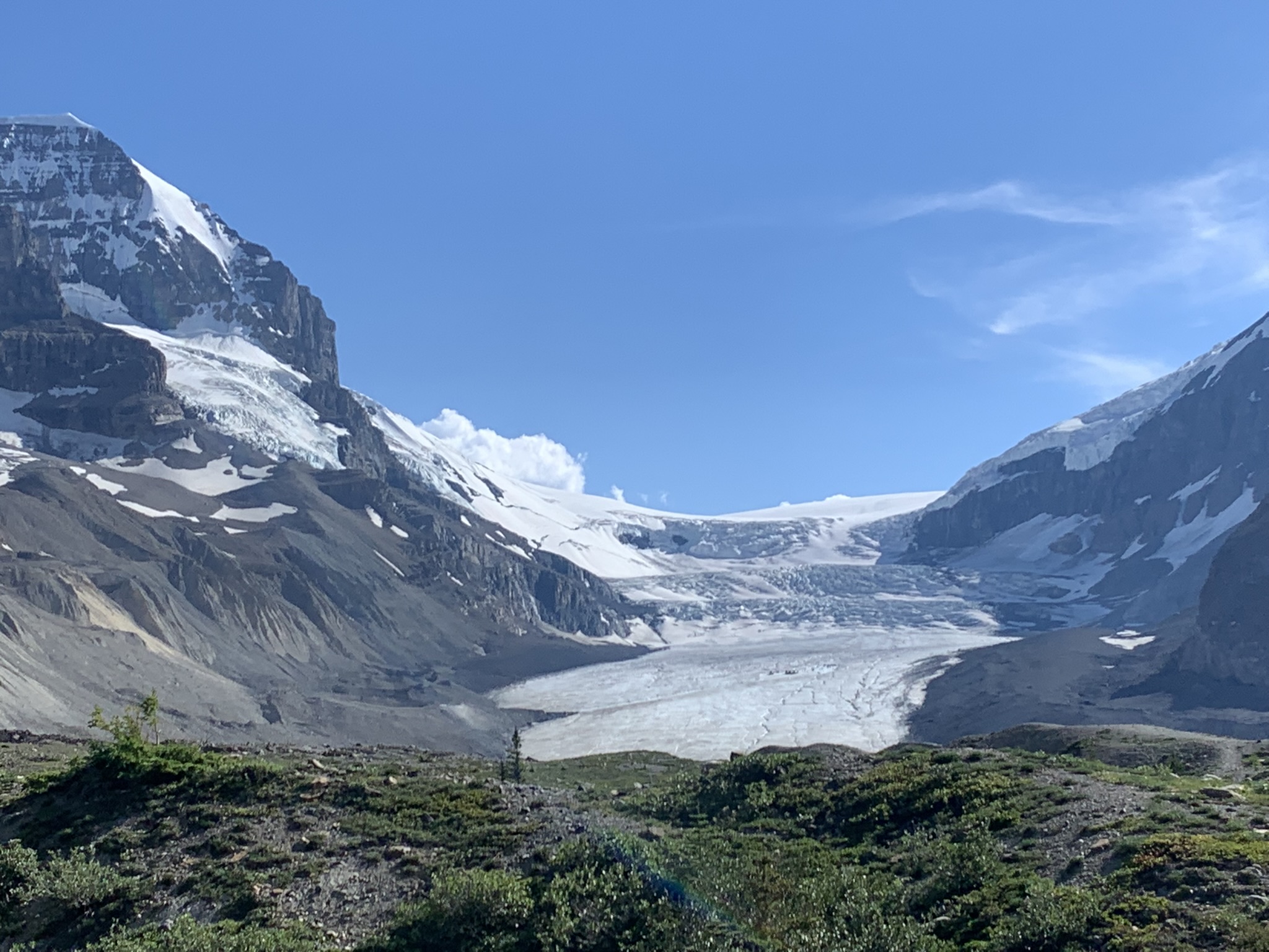
View of the Athabasca Glacier as it flows down from the Columbia Icefield

The hotwater drill set up. We heat up this water and then pump it into a hose to melt holes through about 200 m of ice.
Most of the material was flown up with helicopters, but we did have to haul up a spare heater. I put the picture in black and white, because it reminded me a bit of the methods of the Scott expedition.
Lots of melting and supraglacial rivers that eventually disappear into moulins
In addition to the borehole work we also put up several GPS stations to measure the flow of the ice
This glacier is a bit of a crazy place. Due to the proximity of the Icefield Parkway, it is amongst the world's most visited glaciers. One way to get on the glacier is on these big tired glacier buses (one of which is used by the US program in Antarctica) to drive right up on the ice.


David is checking on his borehole instruments

We also set up a radar to measure glacier velocities