Tuesday, May 27, 2014

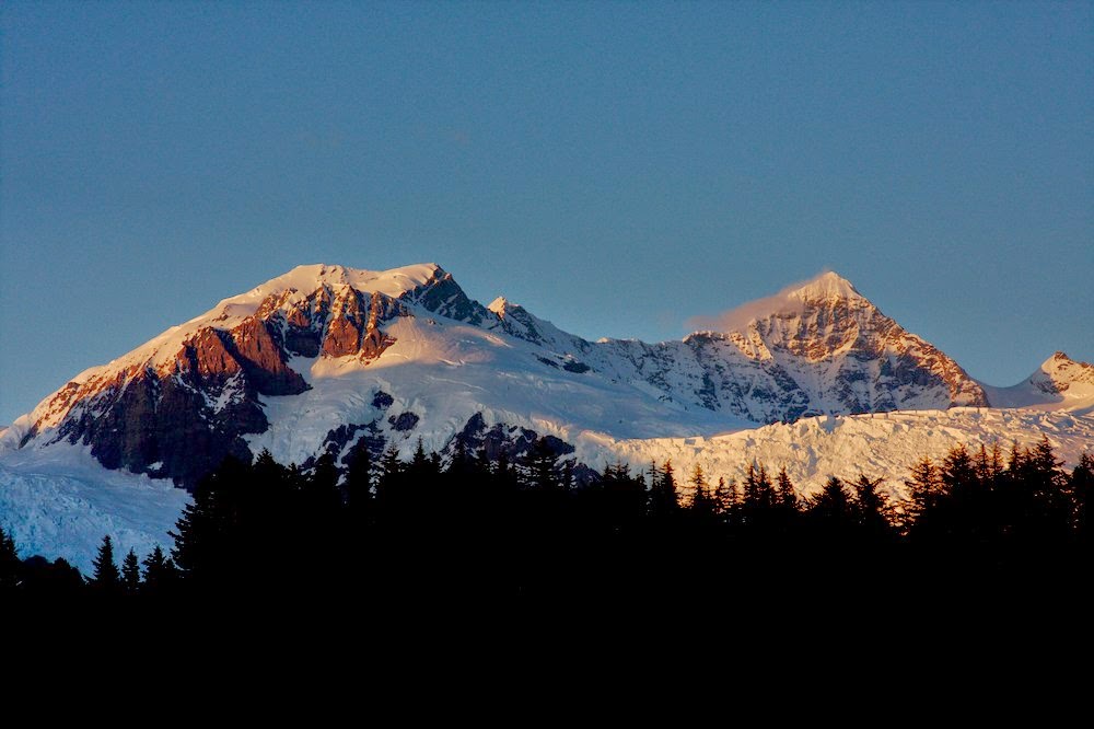
Glacier Bay and the Fairweather mountains

The Fairweather range in Southeast Alaska must surely be among the most spectacular mountain ranges in the world. Mt. Fairweather rises from the Gulf of Alaska to over 4000 m over a distance of only about 20 km and then it drops right back to sea level on its east side towards Glacier Bay (Google maps). The area is heavily glaciated with big glaciers dropping from the peaks to the ocean. The spectacular topography is a result of the very active tectonics of the area with the giant strike/slip Fairweather Fault cutting right along the coast.

Mt. Fairweather. The Fairweather Fault runs along the long straight valley. Alsek Lake is in the foreground

Alsek Glacier and Alsek Lake


Mt. Fairweather with sand beaches in the foreground


Chris and Austin are putting up a GPS base station


Entrance to Lituya Bay. This narrow opening has treacherous tidal currents that have cost many lives, including some members of the first European visitors to the area under La Perouse.


LaPerouse Glacier is the only glacier in Alaska that reaches the outer coast. It has not changed much, in contrast to many glaciers around it. Sometimes, like in this picture, it is separated from ocean by a narrow beach, but sometimes it calves directly into the ocean.

The Glacier Bay altimetry program is quite extensive, and cannot be flown in a single day. So we camped at the beach.


LaPerouse Glacier

LaPerouse Glacier descends very steeply towards the ocean

An advancing glacier in Lituya Bay. This glacier has separated itself from tidewater and is no longer losing mass through calving. As long as it maintains sediments in front of it, it is able to advance.


Lituya Bay. An earthquake in 1958 caused a rockfall into the bay, which caused the biggest recorded wave in history. It reached up to 500 m above sea level. The scar can still be seen on the right side of the image. The lighter vegetation marks the area that was stripped by the wave.


Melbern Glacier and Lake

Monday, May 26, 2014

Airborne glacier science

For almost two decades the glaciology group has measured glacier surface elevations in Alaska with a laser flown on (relatively) small aircraft. Originally this was done with a small two-seater piper PA-12, but for the last decade or so from a much more powerful Single Otter turbine aircraft, operated by Paul Claus of Ultima Thule Outfitters. These measurements form the basis of glacier change assessments in the Alaska, the Yukon and much of British Colombia, some of the most rapidly changing areas of the world. Chris Larsen has been in charge of this program for many years, and this year I had the chance to be part of it and deploy a radar to measure ice thickness. The beauty of this program is that you can only fly in the mountains when the weather is good. So we get to see some of the most amazing mountains on Earth during this work. Below are some impressions from this May. I'll put up a few more posts from the different areas we visited.

The Ultima Thule Lodge, from where we base our operations

Frozen glacier lake

Terminus of Logan Glacier

Hanging ice in the St.Elias mountains

Ocean waves reflecting off the shore


Snow runnels. They are common, but I don't know what causes them


Lenticular clouds forming: it's windy!

Tuesday, April 22, 2014

Annual Black Rapids trip

This was a quick three-day trip to Black Rapids to get all instruments ready for the summer. Just as last year, it was quite windy on the glacier and the slopes were so wind-loaded that I didn't dare going there to put up the cameras that we use to watch lake drainages.
The snow pack was quite unusual: Near the glacier terminus, there was no snow. It had all melted in an extreme warm event this winter. But the upper glacier had a record snow pack. This came right after the most ice loss there in 40 years of measurements.

Camp in the Lokket tributary

Nice view of Hayes from the Richardson Highway

The night we cam back there was a lunar eclipse. Here it is just starting (over the Tanana River)

Almost at full eclipse

Wednesday, April 9, 2014

Taku Glacier

We just started a new project on the Taku Glacier. The goal is to take a closer look at glacier erosion. This glacier is amazing. In previous work we have found that it can excavate as much as 3 m of sediment per year. That is, the glacier is primarily growing at the bottom, by digging itself into soft sediments. Over the next three years we will take a detailed look at how this works. Last week we used radar and seismics to map the glacier bed. With a detailed seismic survey we hope to also find the depth of the sediments under the ice. Next year we will drill through the glacier to find out how it moves over its substrate.

Here are some pictures from this year's field work:

The Juneau Icefield

View from the camp site: Split Thumb

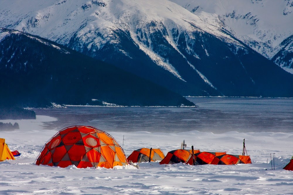
The tent camp

Alessio working on the seismic line on a windy day

The camp with the ocean in the background. If Taku kept advancing, it would eventually cut off the Taku River and create a huge lake. This has happened in the historic past, but the warming climate is unlikely to sustain the current advance for much longer.

The first days were quite windy with lots of blowing snow

The first wiggles show the return of seismic waves from the glacier bed

Orion on a clear night


At the moment, Taku Glacier is still advancing

Roman inspects the sediment bulges in front of the advancing ice

A tree is no match for advancing ice

Ice advancing over sediment

And the yellow bird that's taking us home again.

Flight to Juneau

I flew to Juneau for some field work on Taku Glacier last week. We experienced one of these days were all of Alaska had beautiful weather. On such a day, this must be one of the most amazing commercial jet flights there are. From Fairbanks to Anchorage we got a very close look of Denali, but the windows were too dirty for good pictures. Below are a few that I took on the way to Juneau from Anchorage.

College Fjord with Harvard and Yale Glacier, one is advancing, the other one retreating

Meares Glacier in Prince William Sound

Columbia Glacier: 20 years ago all of the water in this picture would have still been ice covered. Just a few years ago it separated into the two different branches.

A look over the upper Columbia Glacier into the Tazlina Glacier and into interior Alaska.

The Wrangell volcanoes (Drum, Sanford, Mt. Wrangell) in the background. These are the most inland volcanoes in Alaska. Mt. Wrangell (the big shield volcano on the right) is still thermally active with occasional steam plumes.

A look into the Copper River that cuts right through the Chugach Mountains. The Childs and Miles Glacier come into the river valley from either side. One can recognize the Million Dollar Bridge that was built as part of the railroad from Cordova to McCarthy to extract copper. It was abandoned in the late 1930s.

Parts of the Bering Glacier and the Bagley Ice Valley, the largest continuous ice mass in Alaska. In the background are the Wrangell volcanoes.

Icy Bay with Yahtse Glacier on the right


Tyndall Glacier descends from the 5400 m high Mt. St.Elias to sea level, probably one of the largest drops in elevation anywhere on the planet. In the background is Canada's highest mountain; the massive Mt. Logan.


A look from the large Malaspina Glacier through the 'Seward Throat' into the Bagley Ice Valley

Hubbard Glacier, one of the few advancing glaciers on Earth

Another look into the Hubbard Glacier. On the right is Russell Fiord, which might become a lake if the glacier keeps advancing.

Yakutat Glacier. We had a project there during the past few years and the glacier has lost more than 10 km2 of ice and separated into two branches in the past few years. The glacier front is difficult to recognize here, because of the frozen lake.

Alsek Lake and Alsek Glacier

Alsek Lake

And finally: landing in Juneau with Mendenhall Glacier.
What a flight!

Tuesday, January 14, 2014

More radar: Bisgletscher

Last week we took the radar to another spectacular spot: We flew up to Domhuette in Mattertal to look at Bisgletscher across the valley. Bisgletscher has been moving pretty rapidly and there is concern that pieces could fall off and threaten the road and railway near Randa.


Below is a view from Domhuette. The mountain across is Weisshorn, at 4,506 m. This picture shows 3000 m of vertical relief. The other side goes up by the same amount, making this the deepest valley in Europe. Just below the summit of Weisshorn is a hanging glacier that has lost major parts in the past. Further down is Bisgletscher, which we tried to survey this time. In the lower right corner are the leftovers from a massive rockfall that occurred in the early 90s.

Below is a radar interferogram calculated from two images taken 15 minutes apart. The colorscale extrapolates the motion that occurred in those 15 minutes (about 10 mm) to meters/day. So the glacier (circled in red) is moving at nearly 1 m/d towards us observers. The non-zero motion that shows up for bedrock is atmospheric noise that I have not yet removed.


Monday, January 6, 2014

Glacier speed with radar

We did a short day trip to Kleine Scheidegg (on the way to Jungfraujoch) to see how well we can measure the flow of hanging ice with a ground based radar interferometer. This is a nice instrument, built by Gamma Remote Sensing that can measure displacements as small as a few millimeters. In the case of Eigergletscher it took a few hours to get sufficient displacements.

The radar, ready to go.


Eigergletscher
And here is Eigergletscher as seen by the radar. The picture shows an interferogram taken from two images separated by several hours. The colored fringes near the center correspond to 8 mm of motion for one color cycle. Since we can count about three cycles, that corresponds to 24 mm of displacement.