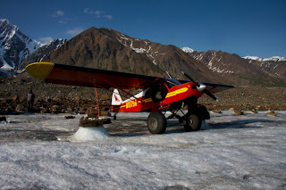
Since we've installed GPS stations in April, all the snow and quite a bit of ice has melted. The antennas that were originally at the surface were now sticking up by almost 3 m. We put them near the surface again, so they would be more stable.
 |
Black Rapids was exposed to several really large landslides during the Denali Fault earthquake of 2002. The debris protects the glacier from melting, so every year, the rock covered ice stands out more, as the uncovered ice continues to melt. This also leads to the formation of lakes that occasionally drain.
One of the goals of this project is to measure how lake drainages affect the flow of the glacier, particularly in the area where the two main tributaries meet. Below is a timelapse sequence of the slow filling and rapid drainage of one ice marginal lake.


