Monday, April 29, 2013

Cold spring on Black Rapids Glacier

We're just back from an April trip to Black Rapids Glacier. Usually this is a pretty enjoyable and warm time of the year with nice spring snow. This year turned out to be mostly cold and windy, but the weather was still quite beautiful. In fact, interior Alaska is experiencing one of the coldest Aprils on record.

We set up some GPS stations to measure the ice flow in an area where the glacier is met by a large tributary. We'll be watching how the tributary reacts when the main branch speeds up during times of draining lakes. We are also interested in the shape of the glacier bed, so we did a lot of radar measurements. This works by sending a low frequency radar wave through the 500-600 m thick ice and measuring the time it takes it to return to the surface.

Camp put-in with Paul Claus and the very capable Ultima Thule Single Otter

Camp in the Lokket tributary

Camp from a bit further away

Lee is checking the radar receiver to make sure it is working properly

The impressive south face of Mt. McGinnis

Mt. Silvertip across the Delta River valley

Chris looking lost in a white-out

Looking down on the 'potholes'. These holes fill with water in the summer and when they drain to the base, the glacier speeds up. We set up cameras to watch them fill and drain.

Christie climbing to one of the camera locations


Friday, March 29, 2013

The Wrangell-St.Elias Mountains

Yesterday we had one of these rare days with clear weather along Alaska's coastal mountains. We took advantage of it with a long day of surveying. This gave us a chance to see some of the most spectacular mountain landscapes on this planet.

First we flew Yahtse Glacier in Icy Bay. Icy Bay is an incredible place. The mountains rise straight out of the sea up to the towering 5,400 m high Mt. St. Elias.
Wind scouring patterns on Yahtse Glacier

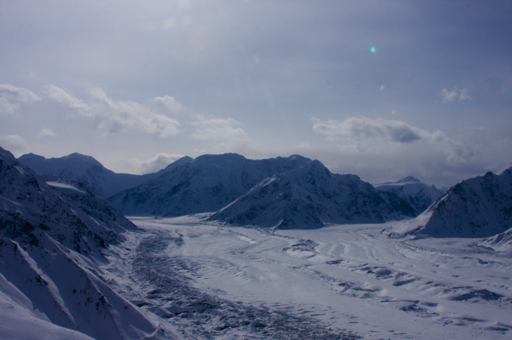
Upper Yahtse Glacier


Looking down the steep terminus of Yahtse Glacier

Icy Bay

Yahtse Glacier, one of Alaska's few advancing glaciers
Icy Bay

After Icy Bay we headed south-east along the coast across the vast expanse of Malaspina Glacier.


Next was Yakutat Glacier, a place we had studied extensively during the past few years as part of an NSF funded project. Yakutat Glacier is one of the most rapidly retreating glaciers in Alaska. It calves into a lake and has lost several kilometers of its frontal area in just a few years. The glacier front is hard to recognize compared to just two years ago.


The front of the West Branch

Crevasse patterns on the West Branch
The East Branch still has some floating ice, but it is rapidly breaking apart

Next up was the Hubbard Glacier, North America's longest tidewater glacier

Hubbard Glacier is healthily advancing. Twice already it has pinched off Russell Fjord at this location. In the back is Turner Glacier, Alaska's only surging tidewater glacier. It is surging again, for the third time in just ten years

The tide is moving glacial silty water into Russell Fjord

Some impressions from the upper Hubbard Glacier


Is Logan Glacier surging?

Three days ago we surveyed the Logan Glacier, which flows from Mt. Logan (North America's second highest mountain and Canada's highest) into the Chitina Valley. During the survey we saw signs of a surge. This glacier is not known to surge, but some unmistakable signs include very active shear margins and crevassing, and a bulge that is expected to travel down glacier over the coming months.
Shear margin with active crevasses
Ice bulge with lots of new crevasses
Paul enlists Chris' help to check the engine on his plance


A draining glacier lake left this pattern as the ice collapsed

Airborne radar

 This week we are based at Ultima Thule Lodge, from where we conduct airborne radio echo sounding measurements to find out how deep the glaciers and ice fields are. The lodge is located in the middle of the Wrangell-St.Elias National Park and provides easy access to some of the biggest glaciers and ice fields outside the polar regions.


 The lodge is located in the Chitina valley, an expansive valley with steep side walls and many water falls that form spectacular ice falls in the winter.


The valley is also a favorite place for sheep and goats. Can you spot the one behind the ice pillar?


Friday, January 18, 2013

PIG - the movie

Forrest McCarthy was a mountaineer on our PIG expedition. Mountaineer is a strange term, since it is about as flat as it gets there. But he, together with Einar Steinarsson, was responsible for safe conduct in the heavily crevassed areas. He put together this nice video of field impressions


Thursday, January 17, 2013

PIG – The crack


The Pine Island Glacier flows into the ocean. It loses mass by melting of ice by warm ocean water from underneath and by calving big ice bergs. Calving happens every few years, when a big ice berg is released into the ocean. The satellite image below (collected by TerraSAR X) shows a crack where the next ice berg is about to be released. This radar picture was taken in early January. Not only does it show the crack, but the linear feature at the lower right shows the snow machine traverse track between our different field camps!

Our field site was only 20 km away from the crack, so we got to fly over and have a look.
Snow drifting into the crack

The crack in early December. It is almost entirely connected across the shelf


Airplane shadow in the crack

Wednesday, January 16, 2013

Master driller Dale


Dale Pomraning (here with Penn State grad student Kiya Rivermann) is our hot-water drill extraordinaire. When we came back to the main camp at PIG, the camp manager, Dean Einarsson introduced us as: “Dale Pomraning and Martin Truffer, master driller and PI”. The way he said it seemed to refer to me as master driller, so Dale's feelings were hurt. Dean corrected this the next day with an official apology, which went along the following lines:

“Dale invented drilling in 1801. Before that people were mostly just digging in the sand with their bare hands. Since then he has been involved in many projects. Some of you might be familiar with Old Faithful? Since 1973, he has continuously drilled in Antarctica. He is the master driller for the PIG project. Martin does not know anything about drilling and mostly just stands around.”

Dale accepted the apology.