We set up some GPS stations to measure the ice flow in an area where the glacier is met by a large tributary. We'll be watching how the tributary reacts when the main branch speeds up during times of draining lakes. We are also interested in the shape of the glacier bed, so we did a lot of radar measurements. This works by sending a low frequency radar wave through the 500-600 m thick ice and measuring the time it takes it to return to the surface.
 |
| Camp put-in with Paul Claus and the very capable Ultima Thule Single Otter |
 |
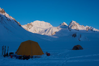
| Camp in the Lokket tributary |
 |
| Camp from a bit further away |
 |
| Lee is checking the radar receiver to make sure it is working properly |
 |
| The impressive south face of Mt. McGinnis |
 |
| Mt. Silvertip across the Delta River valley |
 |
| Chris looking lost in a white-out |
 |
| Looking down on the 'potholes'. These holes fill with water in the summer and when they drain to the base, the glacier speeds up. We set up cameras to watch them fill and drain. |
 |
| Christie climbing to one of the camera locations |

No comments:
Post a Comment