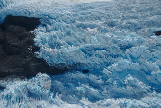
We started the fall campaign with a survey of Icy Bay. This is an incredible place with some of the steepest mountains in the world (Mt. St.Elias rises straight out of the ocean and extends to over 5400 m). The combination of ocean, huge mountains and very active glaciers is simply awe inspiring. Below are some impressions:
 |
| This is the other arm of Icy Bay. All of the water in this and the previous picture was glacier covered a hundred years ago. |
 |
| The Yahtse Glacier is now readvancing. |
 |
| Icy Bay is full of spectacular water falls |
 |
| ... and some amazing geology. |
 |
| This is an disintegrating dirty ice berg. This is how glacial material slowly covers proglacial fjord bottoms |
 |
| Moraine pattern on the nearby Malaspina Glacier |
 |
| The Malaspina Glacier is rapidly thinning and retreating into a series of proglacial lakes. Some of these lake are only barely separated from the ocean. |
 |
| A drained lake that formed on top of debris-covered ice |
 |
| Overview of Icy Bay on the way home. |


No comments:
Post a Comment