 |
| Much of the ice has become so stagnant that trees are growing on top of the glacier! |
 |
| The vast expense of the Malaspina Glacier |
 |
| Collapsing ice is the only indication that this tree-covered landscape is actually a glacier |
 |
| Looking out from near St.Elias towards the Pacific Ocean |
 |
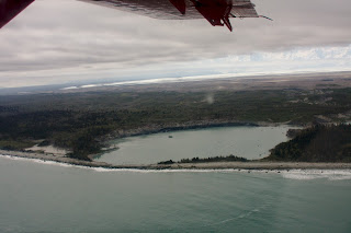
| Ocean water is reaching the glacier front in this lagoon. If the glacier started to calve ice into lakes like this, the demise of the ice could be accelerated greatly. |
 |
| Moraine patterns |
 |
| An example of a radar profile. Radar waves can penetrate several 100 m's into glacier ice and measure its thickness. |

No comments:
Post a Comment