We often use cameras to document ice front positions and glacier flow. Here is an example from three months of motion at KNS. Unfortunately, the glass on the camera box got sandblasted, so the quality is not great. But isn't it fun to see the ice flow like that?
Tuesday, April 27, 2010
Kangiata Nunata Sermia
Kangiata Nunata Sermia is a glacier in Greenland where we just started a new study. We use KNS for short. 'Sermia' is Greenlandic and means glacier.
The glacier is at the end of a long fjord system with Greenland's capital Nuuk at the head of the fjord. The first picture is from just outside Nuuk.

The fjord landscape here is exceedingly complicated, fjords split into several arms, which sometimes rejoin. It is easy to see how one could get hopelessly lost without the help of a map and a GPS. These fjords were all carved by glaciers and the sides are often steep and have impressive walls. KNS is more than 100 km away from Nuuk. As you get closer to the glacier you can see the amount of ice retreat since the end of the Little Ice Age, some time in the 19th century. That line is quite distinct, because the newly revealed land is gray and almost void of vegetation, while the older land is covered in lichen, moss, and shrubs and appears brown. The picture below shows the line quite nicely with a distinct moraine. It also has an interesting lake that is now dammed by an old moraine. But it used to be dammed by ice (on the right side), and it is still possible to see the higher shore lines from that time.

Here is an example of a modern ice-dammed lake. These are quite common on the West side of Greenland. We set up camp near the front of the glacier on a beautiful warm day.

But then the weather turned and the next two days we only had occasional glimpses of the ice through fog, although we could here it rumble all the time.
When the weather turned nice again, we couldn't fly because the Icelanders had decided to send ash our way. But finally the weather and the ash cooperated, and we could fly again. We used helicopters to put GPS stations out on the ice to measure ice movement very precisely.
In this study we are trying to understand how the oceans eat away at the ice fronts and make the glaciers retreat. We cooperate with oceanographers from the Climate Center in Nuuk. Our job is to do glacier measurements, such as its speed and rate of advance and retreat, which can all vary seasonally. Here is a look down the glacier and out the ice covered fjord: The scale is difficult to grasp. It's a bit easier when there is a helicopter for scale. Here is a Bell 212, a helicopter big enough for 9 passengers and 2 pilots:

Can you still see it? The ice near the glacier front is just a jumbled mess, and it is near impossible to tell where the glacier ends and where the ocean starts. That's not so uncommon in late winter, and I expect things to clear out quite a bit in summer.


Sometimes one can find patches of ocean water near the glacier's front.
For now we're done putting out instruments. Let's hope it's all working, so we have lots of good data when we return in late summer. Stay tuned.
The glacier is at the end of a long fjord system with Greenland's capital Nuuk at the head of the fjord. The first picture is from just outside Nuuk.

The fjord landscape here is exceedingly complicated, fjords split into several arms, which sometimes rejoin. It is easy to see how one could get hopelessly lost without the help of a map and a GPS. These fjords were all carved by glaciers and the sides are often steep and have impressive walls.
 KNS is more than 100 km away from Nuuk. As you get closer to the glacier you can see the amount of ice retreat since the end of the Little Ice Age, some time in the 19th century. That line is quite distinct, because the newly revealed land is gray and almost void of vegetation, while the older land is covered in lichen, moss, and shrubs and appears brown. The picture below shows the line quite nicely with a distinct moraine. It also has an interesting lake that is now dammed by an old moraine. But it used to be dammed by ice (on the right side), and it is still possible to see the higher shore lines from that time.
Here is an example of a modern ice-dammed lake. These are quite common on the West side of Greenland.
 We set up camp near the front of the glacier on a beautiful warm day.
But then the weather turned and the next two days we only had occasional glimpses of the ice through fog, although we could here it rumble all the time.

When the weather turned nice again, we couldn't fly because the Icelanders had decided to send ash our way. But finally the weather and the ash cooperated, and we could fly again. We used helicopters to put GPS stations out on the ice to measure ice movement very precisely.
In this study we are trying to understand how the oceans eat away at the ice fronts and make the glaciers retreat. We cooperate with oceanographers from the Climate Center in Nuuk. Our job is to do glacier measurements, such as its speed and rate of advance and retreat, which can all vary seasonally. Here is a look down the glacier and out the ice covered fjord:
 The scale is difficult to grasp. It's a bit easier when there is a helicopter for scale. Here is a Bell 212, a helicopter big enough for 9 passengers and 2 pilots:
Can you still see it?
 The ice near the glacier front is just a jumbled mess, and it is near impossible to tell where the glacier ends and where the ocean starts. That's not so uncommon in late winter, and I expect things to clear out quite a bit in summer.

Sometimes one can find patches of ocean water near the glacier's front.

For now we're done putting out instruments. Let's hope it's all working, so we have lots of good data when we return in late summer. Stay tuned.
Thursday, April 15, 2010
Flying to Greenland
This year I don't spend much time at home. This time it's off to Greenland. From the US it can be a long way, either via Copenhagen or Iceland. As federally funded scientists we get to take advantage of military flights. About once a year, NSF contracts the New York Air National Guard to fly a C-5 Galaxy to Greenland. This is the largest aircraft in the US military and can transport up to 200,000 pounds. It is quite an impressive sight when it shows up at the airport in Kangerlussuaq (West Greenland)

Usually, we get to fly in the military transport workhorse: The C-130 Hercules. Here is one, looking tiny in the distance underneath a C-5 turbine. The Air National Guard operates C-130 on wheel skis, so they operate on the icesheet, both in Greenland and Antarctica.
 For some reason, Kangerlussuaq also had a visit from the German military. The picture shows two C-160 military transport planes. These are supposed to be replaced with a new European transporter, the notoriously delayed and over budget A400M.
 But here is the real workhorse of Antarctic and Greenlandic glaciology: The Twin Otter, flown by Kenn Borek Air from Canada. They have the largest Twin Otter fleet in the world.
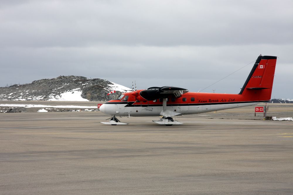
Monday, April 5, 2010
A day trip to Black Rapids Glacier
Today we did a quick trip to Black Rapids Glacier in the Alaska Range. I know this glacier well, since I spent a lot of time up there during my PhD thesis work. Now we're just trying to keep some basic mass balance and velocity measurements going. Because this work is not funded, I rely on the help of some pilots to get me up there. This year Martin Stuefer and Chris Larsen volunteered. Together with Sam Herreid we took advantage of a beautiful warm spring day to land on the glacier and measure our stakes.
 Martin Stuefer's PA12 and Chris Larsen's Cessna 140 on the upper Black Rapids Glacier (the Trinity Basin, named after the three peaks in the background).
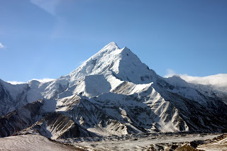 Mt. Hayes, on the way to the glacier.
 During the M7.2 Denali Fault Earthquake several big landslides came down on Black Rapids Glacier. The rock protects the underlying ice from melting, so now it stands out quite prominently. The left side of the picture is glacier covered by rock, and the right side shows some clean glacier ice that has melted down several meters in the intervening years.
 A few years ago the McGinnis Glacier in the Alaska Range had a short and vigorous surge, when the whole glacier started moving very fast for a few weeks to months. This picture shows what's left over. This is actually a glacier, even though it is entirely covered in dirt. But the steep front from the surge is still clearly visible after several years.
Sunday, April 4, 2010
Exit Glacier
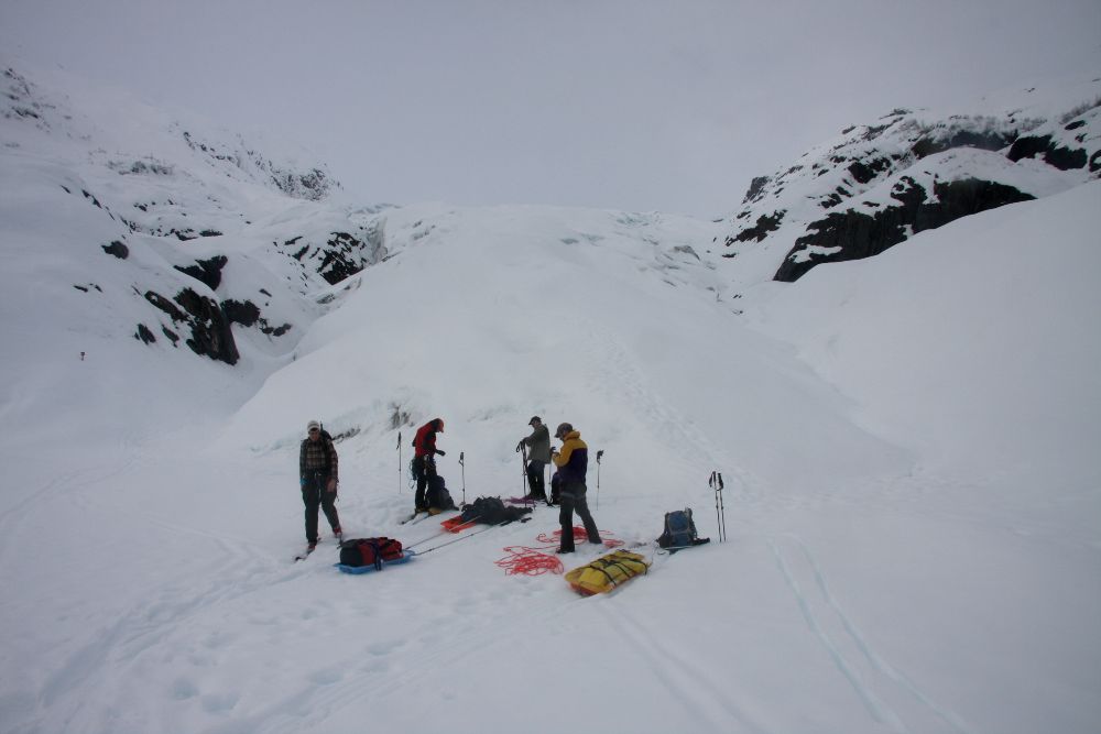
We spent the last four days doing radio echo sounding work on the Exit Glacier near Seward, Alaska. Exit Glacier is one of the outlets of the Harding Icefield. It is quite easy to access, as a road leads to a National Park Visitor Center at the toe of the glacier. The road is closed in winter, so we used snow machines to access the bottom of the glacier and then proceeded on skis. The original plan was to fly to the highest part of the glacier and work our way down. But the weather was bad and the forecast didn't look promising, so we did it the hard way, and skinned up the glacier hauling our gear. There were five of us, Marijke and myself from UAF, Fritz, Mike and Chuck from the National Park Service. The goal was to measure the ice thickness on the Exit Glacier and along some profiles on the Harding Ice Field.
We had a nice tent camp at about 800 m elevation, from where we did daily trips with the radar equipment, dragging 30 m long transmitting and receiving antennas across the glacier. Every day the weather just kept improving and by Saturday we had a glorious day. We made it out just in time before the next weather system moved in. By Sunday morning there was snow and sleet in Seward, but by then we were on the way home.

Gearing up at the bottom of the glacier; no weather for flying.

Heading up Exit Glacier with sleds and heavy packs

Chuck likes digging, so we had a nice tent camp. Marijke and Chuck are getting dinner ready.
 Pulling the radar sleds and antennas
 The Harding Icefield
 A view down Exit Glacier
 Coming back down through the ice fall
 The terminus of Exit Glacier, which has been retreating quite dramatically in the last decade or more.
We had a nice tent camp at about 800 m elevation, from where we did daily trips with the radar equipment, dragging 30 m long transmitting and receiving antennas across the glacier. Every day the weather just kept improving and by Saturday we had a glorious day. We made it out just in time before the next weather system moved in. By Sunday morning there was snow and sleet in Seward, but by then we were on the way home.
Gearing up at the bottom of the glacier; no weather for flying.

Heading up Exit Glacier with sleds and heavy packs

Chuck likes digging, so we had a nice tent camp. Marijke and Chuck are getting dinner ready.
 Pulling the radar sleds and antennas
 The Harding Icefield
 A view down Exit Glacier
 Coming back down through the ice fall
 The terminus of Exit Glacier, which has been retreating quite dramatically in the last decade or more.
Subscribe to:
Posts (Atom)